Tap any parcel in Hawaii and get the full picture — ownership, zoning, assessed value, flood zone, lava hazard, and permit history. All four counties.
TestFlight invite within 24 hours · iOS only · No spam
You're on the list. Check your inbox for a TestFlight invite.
Tap any parcel. The panel fills instantly from county and state records.
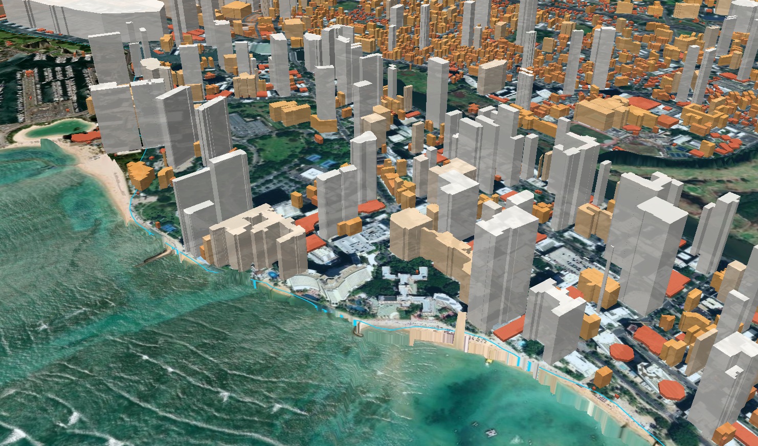
Every orange boundary is a distinct parcel — tap any one for ownership, zoning, assessed value, and risk data. Waikiki hotel district, Honolulu.
Owner, TMK, zoning, assessed value, and risk data — one tap, any parcel.
Permit feed for any location — new structures, ADUs, demolitions, and more.
Tap any parcel. Free gives you ownership and zoning. Pro gives you the full intelligence picture.
Start free. Upgrade when you need the full picture.
Basic parcel intelligence for anyone curious about Hawaii land.
Full data for buyers, renters, and landowners who need real answers.
For professionals who read land for a living and bill by the decision.
iOS subscriptions managed via App Store. One-time PDF report available at $6.99 without a subscription. Web access included with any paid plan.
What it does
Owner, TMK, acreage, zoning, and last recorded sale — pulled from county records statewide.
See assessed value per sqft across a neighborhood at a glance. Spot outliers before anyone else does.
County building permits filed nearby. Know what's being built or demolished before it shows up anywhere else.
Base Flood Elevation at the exact parcel you're standing on, not just the zone boundary.
Push parcel boundaries to Avenza, Gaia GPS, or any GIS app that reads standard field formats.
Watch any parcel and get notified when ownership, zoning, assessed value, or permits change.
Real workflows, not hypotheticals.
You're walking a client through a listing before the offer deadline. The seller's agent quotes the assessed value. You pull up Atlas while still in the driveway. Zone A-2, 65 ft height limit, 2.2 FAR — it's a development play, not just a home. Flood zone AE, BFE 10 ft. Last recorded sale was $1.15M in 2022, assessed today at $890K. The gap between sale price and assessment is a signal worth digging into before your client writes a check.
Before driving to a site visit for a new construction bid, pull up the parcel. R-5 zone means a 5,000 sf minimum lot — the lot is 6,200 sf. Front setback 20 ft, rear 15 ft, side 5 ft each. No permits filed in the last three years. You can calculate the legal building envelope — roughly 62 by 40 ft of buildable pad — before you leave the office. When the client walks you through what they want, you already know whether the footprint is legal and whether it will require a variance.
Scanning AG-2 parcels on the west side of Hawaii Island for undervalued land. Pull up a 3.1-acre lot listed at $295K. Atlas shows lava zone 6 — Hualalai last erupted in 1801, manageable risk. Flood zone X, no FEMA exposure. No permits in the last decade. One farm dwelling on record, agricultural use unclear. Comparable AG-2 Zone 6 parcels with recent activity are trading at $85–95K per acre. This one is at $95K per acre — priced correctly for what it is, not an outlier. Pass, and move to the next one.
You're developing a mid-rise on a parcel in Kaimuki. Three lots across the street are owned by an entity you don't recognize. You set a change alert on all three. Six weeks later: a building permit is filed on the corner lot — new structure, 28 units, 65 ft height. You now know your future context six months before any signage goes up, before the neighborhood association finds out, and well before anyone asks you about it at a planning meeting.
All four counties. One app.
Or just can't stop thinking about it.
ʻĀina Atlas is part of a family of purpose-built software for industries with real physical consequences.
Beta is open now via TestFlight. Drop your email and we'll send an invite within 24 hours.
iOS only · No spam · Unsubscribe any time
You're on the list. Check your inbox for a TestFlight invite.